Showing posts with label Northern Eye Books. Show all posts

Wednesday, April 10, 2013

Visiting Gower... again and again...


Whiteford Point's unusual cast-iron lighthouse can only be reached at low tide
Our first-ever mini break as a couple was a two-day hike from Rhossili, Gower to Mumbles, with an overnight stay at Oxwich. It therefore seems fitting that, six years later, Harri and I have just completed his third walking guidebook on this beautiful Welsh peninsula.

This latest book was by far the quickest to complete in walking terms. Top Ten Walks: Carmarthen Bay and Gower Peninsula was an absolute pleasure to research and easy to walk (the longest walk is just six and a half miles).

Picturesque Pwlldu Bay on the south Gower coast
The scenery on what Harri describes as ‘a small but priceless gem’ is stunning and astonishingly varied. In the introduction to his first Gower book (awaiting publication by Northern Eye Books), he expands, ‘Here are hidden coves and glorious sandy beaches, high cliffs and windswept downs, dunes, marshland, wooded valleys and picturesque villages. Almost every path on Gower opens up a new and rewarding perspective, a different aspect of the peninsula’s varied landscape.'

And he's absolutely right. In the twenty-first century, Gower remains astonishingly unspoilt, in large due to the long-time commitment and determination of the Gower Societywhose mission statement proclaims (or perhaps warns) it's ‘Guarding Gower for all its worth’.

The registered charity was founded way back in 1947. I won’t list all its aims here, just what I consider the most relevant ones:
  • to encourage an appreciation and love of Gower
  • to preserve its character and antiquities, and to oppose any threat to its amenities.
Harri, deep in thought on Rhossili Downs
No-one could dispute the Society's success in preserving Gower's natural landscape, despite what they claim was an unfair portrayal of members as 'the bad guys' in the 2012 BBC 2 mini series, Gower.

True, there has been substantial house building in villages like Llangennith, but on the whole the peninsula remains as wild and unspoilt as it was back in the 1940s, which is quite amazing when you consider its appeal and proximity to Wales’ third largest city, Swansea.

The Gower Society gets full marks for preserving what makes this little peninsula (the winding roads are deceiving – Gower is barely more than 15 miles (24 km) long and seven miles (11km) wide) so special - its incredible natural beauty. 

On that first weekend back in 2007, Harri and I booked into a small bed and breakfast in Oxwich, where the dour-faced proprietor was clearly a graduate from the Basil Fawlty School of Customer Service (either that or she disapproved of our obvious age difference). Despite its popularity, Oxwich, with its population of under 200, boasts just one eaterie, the Oxwich Bay Hotel.  When we showed up, on a Saturday night in June, without a prior booking, it was bursting at the seams. Seeing the dismay on our faces (surely our rumbling tummies weren't that loud?), a kind-hearted staff member (presumably a protégée of Sybil rather than Basil) said we could eat at a table in reception if we didn't mind. We assured him we didn't!

Since that first weekend, we’ve returned to the Gower many times. One memorable place we stayed was The Slope, in Middleton. This tiny space was originally built as a summer dwelling for the owners to move into during the summer when they let their neighbouring (and much larger) home out to holiday-makers. A local tenant farmer, Jack Gibbs, built The Slope in the early 1900s using cliff limestone, handmade bricks and some beach-combed timber. Sadly, he died in World War 1.

The Slope - small but perfectly formed
The building was converted into self-catering accommodation by the present owners in 1994 and the result is delightful. The ground floor combines a kitchen and diningroom and there's a shower/toilet cubicle concealed in an under-stairs cupboards. Upstairs, the open plan bedroom, with its television and comfy chairs, doubles as a sitting room. The Slope is small but perfectly formed; we stayed for four nights and would happily have moved in permanently. 

On another trip we stayed at Greenbank Cottage, Reynoldston, a B & B where the friendly owners have come up with the most brilliant and practical of ideas. Being hikers themselves, they understand how frustrating it is to have an early start thwarted by a slow-to-arrive cooked breakfast. Their solution? To provide a basketful of warm rolls and croissants outside your private French doors at an agreed time. And in case you get the 'nibbles' in the night, there is an assortment of biscuits and other snacks provided (there's a table and chairs and also a very useful fridge). 

Their simple idea means guests can set off as early as they wish (with some nice fresh rolls for lunch!). Other B & B owners, please take note.

There's something quite magical about a beach at low tide
Of course, not all our overnight stays have been so idyllically located. Soaring fuel costs have forced us to look for cheaper accommodation, like the Swansea Travelodge just off the M4 (there's no breakfast but the rooms are clean and spacious and the reception staff are always wonderfully friendly and helpful (more input from Sybil Fawlty perhaps?).

So with Harri’s third Gower book done and dusted, we no longer have our bona fide, i.e. work-related, reason to wander alongside wild ponies grazing peacefully on the salt marsh and mudflats of the north Gower coast or to get wet feet walking to Whiteford Point at low tide. 

There's no pressing need to climb the long, high ridge of Cefn Bryn, struggle against the wind to reach the 193-metre summit of Rhossili Down or to photograph Gower’s amazing views.

There are no longer any work-related reasons to visit Gower, just spiritual ones. 
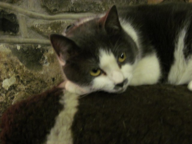
A friendly local on Harding's Down

Top Ten Walks: Carmarthen Bay and Gower Peninsula by Harri Roberts will be published by Northern Eye Books later this year.


Sunday, February 3, 2013

Starter for ten

The snow-covered cliff tops above Marros Sands
There’s nothing quite as exciting as starting a new project, be it a script, a diet or a walking book.


Last week, against a bleak and snowy backdrop, we started our on-the-ground research for Harri’s latest commission: a top 10 walks guidebook to complement his official Wales Coast Path book (Amroth to Swansea Marina)

The top 10 format has already proved a great success for its publisher, Northern Eye Books.

These beautifully designed little books cost just £4.99 and provide clear directions, Ordnance Survey maps, eye-grabbing panoramic photographs and interpretation of points of interest along the way.

Until recently only walks in the Lake District, Peak District and the Yorkshire Dales
were covered, however the good news is that publishers Carl Rogers and Tony Bowerman have decided to roll out the format to include circular walks along the Wales Coast Path. It’s a great idea and will hopefully encourage many more people to explore Wales’ beautiful coastline and nearby countryside.

Still on solid ground - the steps above Pendine 
First to be published in the Wales series was fellow Outdoor Writers Guild member Sioned Bannister’s offering on Cardigan Bay North (available direct from Northern Eye).  

Sioned is the OWG social media expert and she has written a great little book, which I know Harri and I are going to find extremely useful on future holidays. (And in the mean time, we can just enjoy looking at those gorgeous panoramic photographs.)

The snow had all but disappeared when we left Newport but, as we travelled along the M4 corridor, we could see it was a different picture further inland. We later learned that snow had caused widespread disruption in Carmarthenshire the previous day.

‘Do you think snow settles on sand?’ I pondered and, for once, my personal sage could not provide the answer.

There's nothing to beat sun, sea... and snow
There was an empty car park at Pendine and almost nobody about, but we duly paid our £3 parking charge and pulled on extra layers.

My heart sank when Harri headed past the seafront café and towards the steps leading to the cliff top. Now perhaps it would be wise to check in advance what’s expected of me on any given walk, but strangely I always forget to ask pertinent questions like ‘where are we going?’ and Harri sensibly omits to mention words like ‘steep’ ‘mud-bath’ or ‘arduous’ in his pre-walk briefings.

The uphill section was actually fine. There was no ice underfoot and the view across the snow-covered Pendine Sands was spectacular. We trudged across the cliff top in crisp, clean snow, relishing the crunching underfoot and the snow-laden gorse bushes.

It was only when we began to descend to Morfa Bychan beach that things started to become a bit hairy. Mud, it would seem, doesn’t always dry out underneath snow but, when the temperature isn't low enough, lies there oozing and squelchy, ready to send the unsuspecting hiker sliding down the mountainside on their backside. I tiptoed along, envisioning my fate, concerned about doing more damage to an already dodgy right foot, begging Harri to turn back.

Of course, we didn’t because Harri has a book to write and we must walk every inch of every walk – even those which are ultimately rejected. Instead, we headed straight up the opposite cliff, towards Marros Sands

One of Carmarthenshire's churned up fields,
 temporarily covered by snow
I’ve written about this section of the Wales Coast Path several times already so I’m not going to repeat myself. Suffice to say, it’s not pleasant when conditions are wet… and, once again, they were.

A short distance inland and the walking conditions immediately improved, lifting my spirits.

The village of Marros boasts a camping site, a church and an unusual war memorial, modelled on nearby Neolithic tombs. We lunched briefly on the stone benches in the church porch, but it was too cold to linger and we were soon on our way again.

The final stretch of the walk was stunning scenery-wise, however I struggled to get warm again. As we descended into a wooden valley, we came across a stunning log cabin, presumably a holiday let in the warmer months.

The Marros war memorial and church
At low tide, it’s possible to walk from Marros Sands to Pendine along the beach but the timing wasn’t right for us so we walked up an old cobbled path and emerged at the top of Pendine.

The day was closing in, but it seemed too early to head to our functional Travelodge room, so we decided to warm ourselves in Spring Well public house. For anyone who doesn’t know it, the Spring Well is the sort of pub every village/small town should have –  friendly if slightly eccentric locals willing to entertain passing strangers, a heavenly log-burning fire, ginger wine, but best of all, its very own kitler.

This walk may or may not make the final ten but seeing Stella the cat twitching her little grey moustache made the day's cold and muddy conditions worthwhile.

Stella has no idea why she attracts so much attention

Sunday, October 28, 2012

Wales Coast Path: Beachcomber's Cut Part 1


Pendine Sands - a vital stretch of the Wales Coast Path
Nearly two months after completing Harri’s guidebook for the official Wales Coast Path, we were still pondering some of the bizarre route choices, specifically why so many of Wales’ best beaches have been completely bypassed.

Anyway, Harri’s publishers, Northern Eye, were more than happy for him to suggest ‘alternative’ routes where he felt the official route wasn’t particularly scenic (or anywhere near the coast), which is how we found ourselves heading back to the Carmarthenshire stretch yesterday.

The first beach we were planning to ‘reveal’ to would-be Wales coastal hikerswas Pendine. Now there is a very good reason why this seven-mile beach is closed to the public sometimes. During WW2, it was acquired by the Ministry of Defence and most of the beach is still used as a firing range from Monday to Friday.

An MOD watch tower 
At weekends, however, there is no logical reason for the long Wales Coast Path detour along the busy Pendine to Laugharne road. We’ve walked this route three times, twice out and once back, and believe me, it sucks. Anyone expecting a coastal walk will be sorely disappointed as the open sea remains hidden behind swathes of MOD land and views of the estuary only become visible towards the end.

Harri’s plan this weekend was to investigate the more scenic route along Pendine Sands and find out if it was possible to head inland at Ginst Point to reach Sir John’s Hill (which later links to Dylan Thomas’s Birthday Walk ).

As you enter the beach at Pendine, there are signs warning of the dangers of unexploded munitions, but if the red flag is not flying, visitors are permitted to stroll along the firm, sandy beach, for miles if they so wish.


Ripples of sand at low tide
On a bitterly cold but gloriously sunny October morning, we set off to uncover the delights of this magnificent beach, the location for many land speed records.

At the Pendine end, we were surrounded by dog walkers, family groups, holidaymakers, outdoor enthusiasts, even runners with dogs, but gradually, as we clocked up the miles, the people fell away until it was just Harri and me, and a vast expanse of sand, sea and sky.

At low tide, Pendine is a beachcomber’s paradise. As we headed east the sea was barely visible. The hard, damp sand was strewn with shells, driftwood and plastic bottles. We passed the remains of a tree, decorated with garish detritus, presumably by passers-by, a heavy wooden door, numerous oil drums and frequently, bundles of hay woven with knotted nets.

The detritus tree adds a splash of colour to the beach
At Ginst Point, there was good news. After leaving the beach we joined a gravel track leading to two car parks and then walked along the old sea wall embankment, enjoying views across the estuary towards Llansteffan Castle and the old ferry crossing point.

We retraced our steps, which is usually very boring but with the tide in, the beach was transformed and we walked along the water’s edge, me looking for shells and Harri just enjoying the late afternoon sunshine.

Today’s walk took a little longer than usual, mainly because I was experimenting with my new Canon Compact camera. The crisp, cold weather was perfect for landscape photography but it didn’t mean I couldn’t have a little fun with the various settings (my current favourites are monochrome and vivid colours).

Discovering the delights of monochrome

We timed the end of our 18-mile walk perfectly and were just arriving back at Pendine village (too tired even to stop at the pub) as the sun was setting behind the hills of distant Pembrokeshire.

As I pondered which setting to use for that all-important sunset photograph, Harri reminded me that today’s walk had fulfilled all my criteria for the perfect hike: it was coastal, flat, there was no mud and, most important of all, the sun had shone all day.

I agree. It was the perfect hike along a magnificent stretch of sand – so why don’t coast path officials want you to walk it?


Just one of my many sunset photographs 

Friday, September 14, 2012

Day 5 - The Gower 'proper' - Gowerton to Llanridian


A 'beached' boat makes an interesting landmark
It’s hard to believe nearly two years have passed since Harri and I completed his book of circular walks on the Gower peninsula (soon to be published by Northern Eye Books)

Like most people from south east Wales, I’d always felt I knew the Gower peninsula quite well. Once I’d passed my driving test (first time on my 27th birthday with a very freckly-faced examiner), it was easy to pack the girls in the car and head for Rhossili, Port Eynon and Oxwich beaches. Years later, when Dad was living in West Cross, we discovered Pennard and lunched at The Gower Inn regularly.

Beautiful landscapes abound on Gower
Walking Gower with Harri has been an entirely different experience. We did most of our walking in the winter when tourists are few and far between, the roads quiet and the vast beaches practically empty. Harri introduced me to less ‘touristy’ places, like the spine of Gower - Cefn Bryn (more on that in a future blog) – and small inland communities, like Reynoldston, where sheep graze on the village green and cows mill around road signs.

In the introduction to his book, Harri describes the Gower as ‘a small but priceless gem’, adding ‘the peninsula is ... a place of stunning and astonishingly varied natural beauty. Here are hidden coves and glorious sandy beaches, high cliffs and windswept downs, dunes, marshland, wooded valleys and picturesque villages. Almost every path on Gower opens up a new and rewarding perspective, a different aspect of the peninsula’s varied landscape’.

Wow, I couldn’t have put it better myself. It’s true, every word. Gower is absolutely an absolutely stunning part of the world; unfortunately, the high house prices reflect this.
Entertaining local 'residents' in the front garden

These stepping stones are a recent - and very welcome - arrival
Our fifth day’s walking took us along the northern shores of the peninsula, past Penclawdd, Llanmorlais and Crofty.

Until the end of the 19th century, Penclawdd was a thriving sea port but, according to Wikipedia, a 'training' wall built around that time with the intention of confining the fluctuating channel of the River Loughor had the effect of accelerating the silting up of the Penclawdd. 

The modern landscape is compelling if not exactly the stuff of picture postcards; at low tide, the empty mudflats with their deep-sided pills stretch almost as far as the eye can see to Whitford lighthouse and the open sea beyond. Wild horses graze here, inexplicably venturing out into the middle of the estuary at low tide. The few boats that remain tethered along this stretch of coast, relics of more prosperous times, have long since been abandoned to the relentless onslaught of mud.

If you’ve ever enjoyed cockles at Barry Island or Trecco Bay you’ll probably have been eating cockles from Penclawdd. We watched as a convoy of four-wheel drive vehicles and quad bikes edged carefully across the tidal mudflats to reap the day’s harvest before the fast-approaching sea forced them back to the shore. Until the seventies women were the main cockle gatherers, using donkeys to carry their catch back to shore; sadly, today’s obsession with profit and economy of scale has seen an end to this traditional way of cockle fishing.

Wild horses graze on what was once a busy estuary

Our need to return to the car meant that we        could only cover eight miles of the Wales Coast Path today. Rather than hang around for an infrequent - and expensive - bus we instead decided to do a circular route back to Gowerton via Llanrhidian and The Dolphin Inn – or The DolphInn as Harri likes to call it.